- Research
- Fish tagging
- Lumpfish research
- Oceanography
- Seabed mapping
- Arnarfjörður
- Drekasvæði
- Ísafjarðardjúp
- Jökulbanki
- Jökuldjúp
- Kolbeinseyjarhryggur and adjacent area
- Kolluáll
- Langanesgrunn
- Látragrunn
- Nesdjúp
- Reykjaneshryggur and adjacent area
- Selvogsbanki
- South of Selvogsbanki
- South of Skeiðarárdjúp
- South of Skerjadjúp
- Southeast of Lónsdjúp
- Southwest of Jökuldjúp
- Suðausturmið
- Suðurdjúp
- Vesturdjúp
- East of Reykjaneshryggur
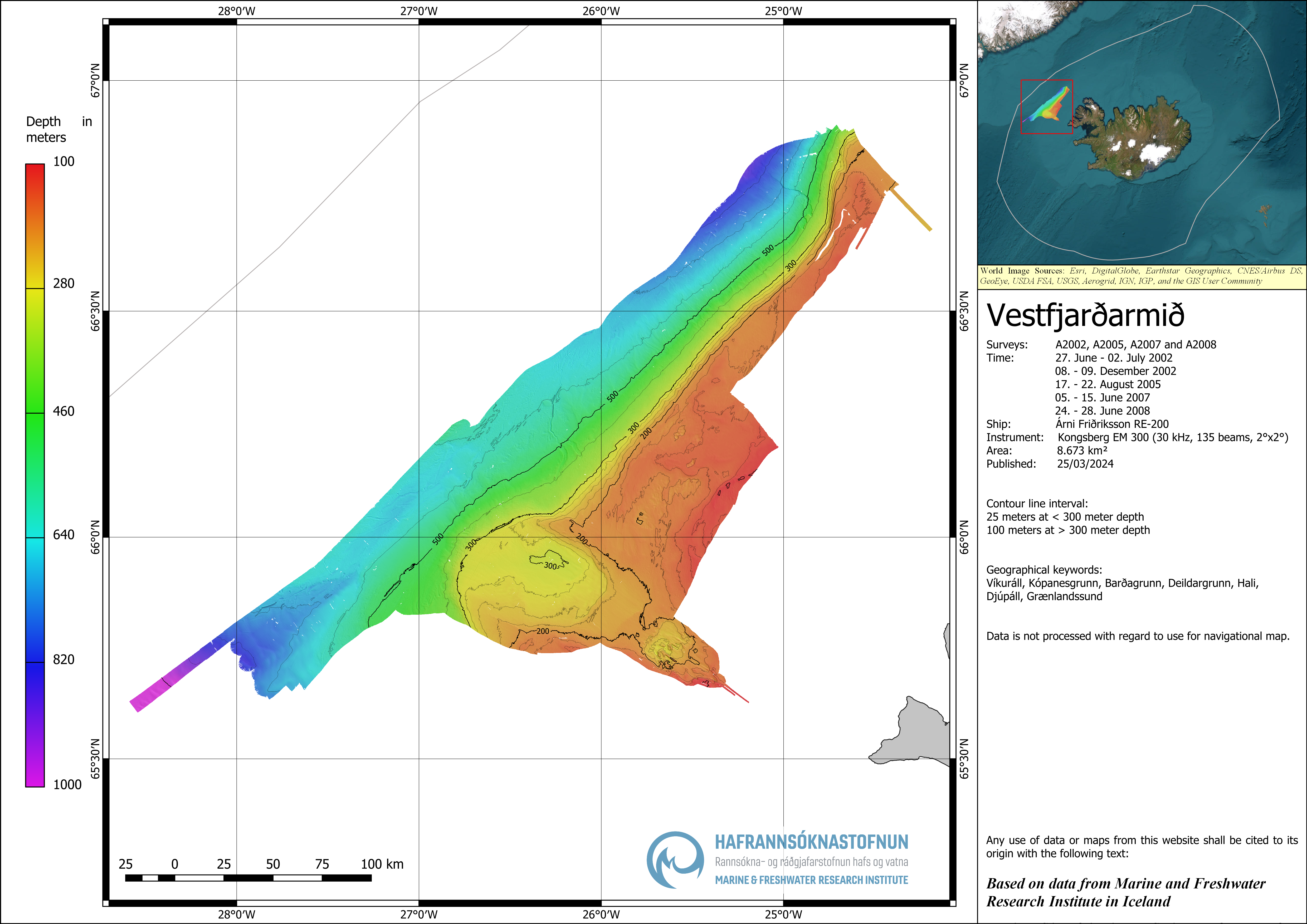
- Vestfjardarmid
- Seal research
- Whale Research
- Advice
- About

Vestfjardarmid
Vestfjardamid
Survey year: 2002, 2005, 2007 og 2008
Post-processing: Raw data was processed and gridded in Caris HIPS & SIPS software with 20 x 20 m grid cell size in ISN2004 projection.
Multibeam data:
- Compressed text file (lat, long, depth): -download
- Raster file, geotiff image: -download.
The multibeam data is not processed with regard to use for navigational map.
Any use of maps or data from this website shall be cited to its origin with the following text:
Based on data from Marine and Freshwater Research Institute in Iceland.
Click here or on the picture to enlarge.